
Map of the Swan River
The first detailed chart to be made of the Swan River in Western Australia overlaid with the rough proximity of modern day suburbs. The original map was created by François Heirisson in 1801 during the 1801-1804 French circumnavigation of the world. For more on their exploration of the Swan River please click here.
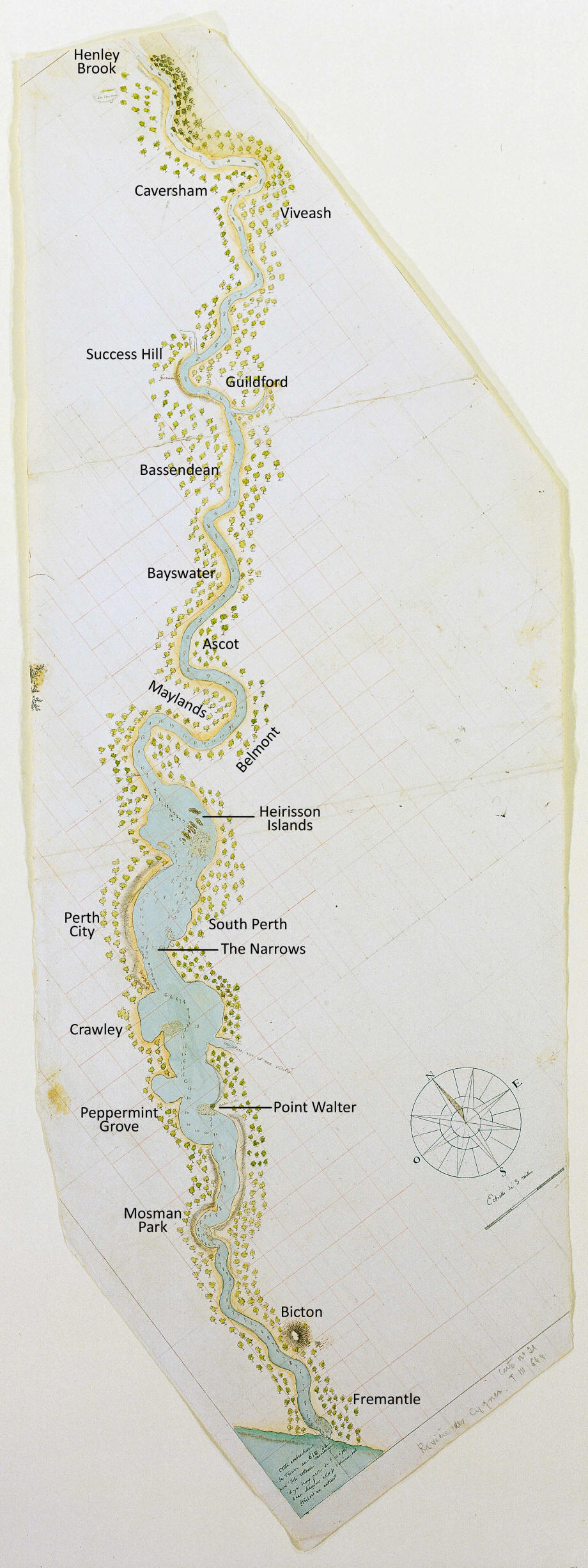
Image courtesy of the State Library of Western Australia
Freycinet Collection: Chart of the Swan River, by Francois-Antoine Boniface Heirisson, 1801
Call Number MN 2146 / slwa_b2112066_30
The first detailed chart to be made of the Swan River in Western Australia overlaid with the rough proximity of modern day suburbs. The original map was created by François Heirisson in 1801 during the 1801-1804 French circumnavigation of the world. For more on their exploration of the Swan River please click here.
Image courtesy of the State Library of Western Australia
Freycinet Collection: Chart of the Swan River, by Francois-Antoine Boniface Heirisson, 1801
Call Number MN 2146 / slwa_b2112066_30


The Freycinet Collection was purchased for the State Library of Western Australia at an auction in London in 2002
You can support future acquisitions by making a tax-deductible donation to the State Library of Western Australia Foundation
Teachers! Click here to download our Freycinet Australian Curriculum education resource ( PDF / 9.34 MB )